|
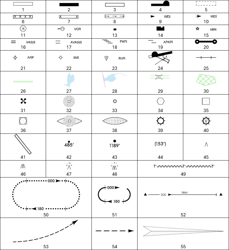
1
|
Unpaved runway, taxiway and/or apron |
|
2
|
Paved runway |
|
3
|
Paved taxiway and/or apron |
|
4
|
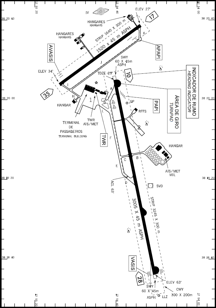
Turnpad |
|
5
|
Construction zone |
|
6
|
Closed taxiway |
|
7
|
Closed runway |
|
8
|
Displaced threshold |
|
9
|
Wind direction indicator |
|
10
|
Illuminated wind direction indicator |
|
11
|
Helicopter landing area |
|
12
|
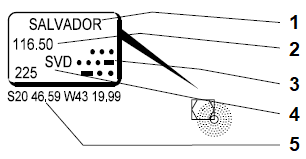
VOR checkpoint |
|
13
|
Control tower |
|
14
|
Building |
|
15
|
Aerodrome beacon |
|
16
|
VASIS |
|
17
|
AVASIS |
|
18
|
PAPI |
|
19
|
APAPI |
|
20
|
Aircraft arresting barrier |
|
21
|
Aerodrome reference point |
|
22
|
Inertial navigation system |
|
23
|
Runway visual range |
|
24
|
Holding position |
|
25
|
Railroad |
|
26
|
Road |
|
27
|
Lake |
|
28
|
Dam |
|
29
|
Bridge |
|
30
|
Urban area |
|
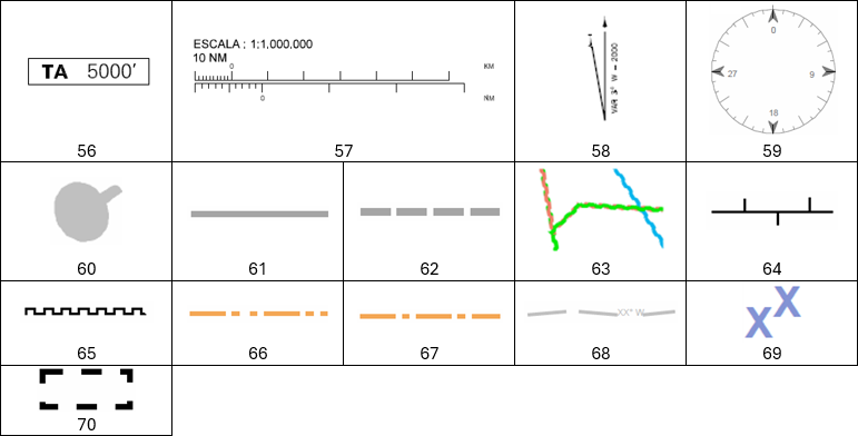
31
|
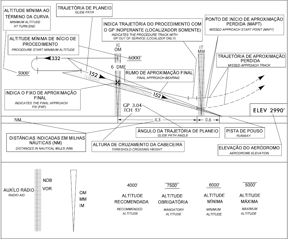
Final approach fix |
|
32
|
NDB |
|
33
|
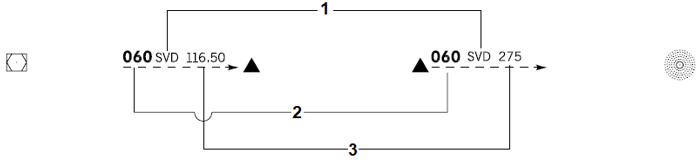
Localizer (LOC) and Glide Path (GP) |
|
34
|
VOR |
|
35
|
DME |
|
36
|
VOR/DME |
|
37
|
Marker and radio aid |
|
38
|
Marker |
|
39
|
IFR aerodrome |
|
40
|
VFR aerodrome |
|
41
|
Main aerodrome used in IAC |
|
42
|
Spot elevation in the terrain |
|
43
|
Highest spot elevation in the region covered by the Chart |
|
44
|
Height |
|
45
|
Obstacle |
|
46
|
Group of obstacles |
|
47
|
Illuminated obstacle |
|
48
|
Group of illuminated obstacle |
|
49
|
Prominent transmission line |
|
50
|
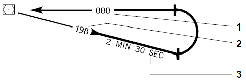
Holding pattern (high) |
|
51
|
Holding pattern (low) |
|
52
|
Climbing path (SID/STAR) |
|
53
|
Missed approach |
|
54
|
VFR path |
|
55
|
Localizer course |
|
56
|
Transition altitude |
|
57
|
Graphic scale |
|
58
|
Magnetic declination |
|
59
|
Compass rose oriented towards Magnetic North |
|
60
|
Controlled airspace |
|
61
|
TMA boundary |
|
62
|
CTR boundary |
|
63
|
Boundaries between TMA sectors (in ARC) |
|
64
|
FIR/UTA boundaries |
|
65
|
Frequency sector boundary |
|
66
|
International border |
|
67
|
State lines |
|
68
|
Isogonic line |
|
69
|
Minimum area altitude |
|
70
|
Area to be detailed in ARC |